GET UPDATES IN YOUR INBOX! Subscribe to our SPAM-free updates here:

GET UPDATES IN YOUR INBOX! Subscribe to our SPAM-free email here:

Delivered by FeedBurner

Showing posts with label Brooklyn. Show all posts

Thursday, November 1, 2018

Postcard Thursday: What's in a Street Name?

image of the Malbone Street subway crash courtesy of the New York Transit Museum

When Governor Andrew Cuomo jokingly (?) suggested the other day that the Newtown Creek be renamed the Amazon River in a bid to woo Amazon's HQ2 to New York, it was easy for historians to get worried. All joking aside, Newtown was the colonial name for the Elmhurst section of Queens, and if the creek were to be renamed, another chapter in the city's history--already all-but forgotten--would be further erased.

But New York has a long history of such street renaming. In Lower Manhattan, as we write in Footprints in New York:
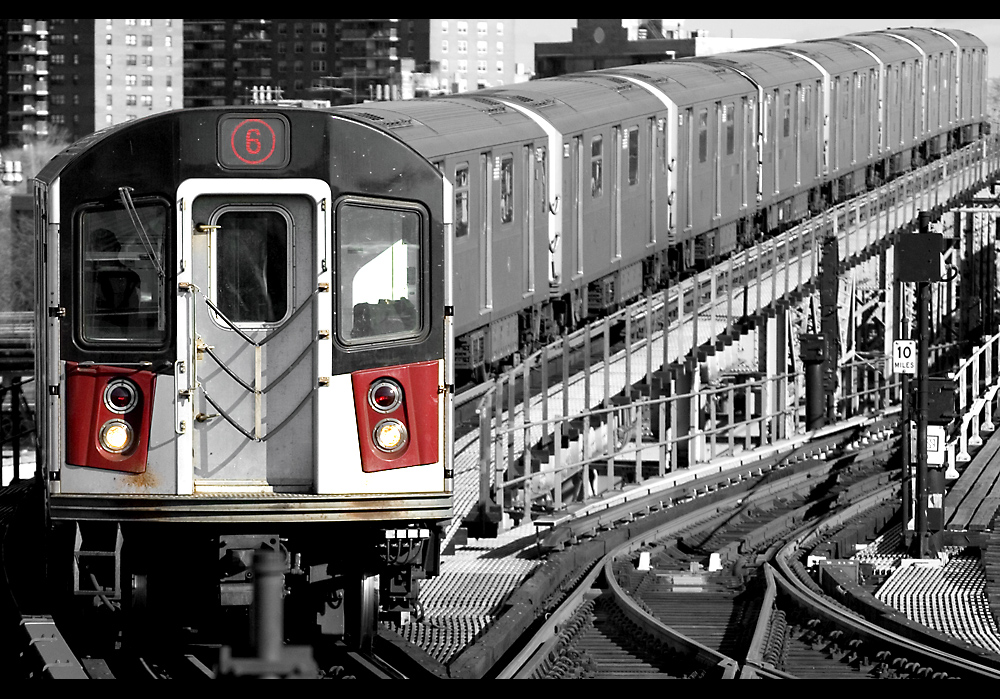
most of the other English names that once defined the city are gone.... [To the English, the Dutch] Pearl Street...was known as Great Dock Street. The nearby Beaver Path—where pelts had once been carried to waiting ships—became Princess Street. During the eighteenth century, new roads were constructed north of Wall Street and given names like Crown, King, and Little Queen.

In a fit of patriotism in 1794, all these British names were swept away. Great Dock reverted to Pearl; in a sort of reverse fairy-tale move, the Princess was turned back into a Beaver. Pointedly, Crown Street became Liberty Street. In this case, history was written by the winners on the street signs.
It isn't just the Newtown Creek renaming that has brought this topic to mind. Today marks the centennial of the worst subway disaster in New York City history, the Malbone Street Wreck. On November 1, 1918, a Brooklyn Rapid Transit subway train traveling at a high rate of speed and piloted by a driver with no experience crashed during the evening rush hour, killing at least 93 people and injuring hundreds.

Today, most people have never heard of Malbone Street. That's because the crash was so horrific that Malbone Street was renamed Empire Boulevard so that people wouldn't associate it with the tragedy. Just as it had done in the early American era, the city was renaming the street in order to forget the past.

However, because so many streets in New York are a little off-kilter, this doesn't always work.


In Lower Manhattan, for example, we still have Hanover Square--named for the British royal family--and Thames Street stands near Trinity Church as a reminder of the city's English roots.

In Brooklyn, one block in Crown Heights remains Malbone Street to this day, as you can see in the Google street view photo above. The map below is from 1898 and shows the issue. Malbone Street had an odd spur--probably the result of street names being appended in the area before there was any sort of comprehensive urban planning--which meant that in the 19th century, Malbone essentially ran parallel to itself for a block. (This is very similar to the issues we still have with Waverley Place in Greenwich Village.)


So, when most of Malbone Street became Empire Boulevard after the subway crash, the spur stayed  Malbone--as it remains to this day.


* * *

Want to hear more about NYC history?
Inside the Apple has recently been released for the first time as an audio book!
Visit Amazon or Audible to download today


Thursday, May 25, 2017

Postcard Thursday: The Ratzer Map


250 years ago, Lieutenant Bernard Ratzer set off across Manhattan and Brooklyn to make the first -- and still, in many ways, best -- comprehensive map of New York City.

A few months ago, James walked in Ratzer's footsteps, looking for traces of the city as it would have been two and half centuries ago. You can read the results in this piece he wrote for Curbed this week, "A Walking Tour of 1767 New York" (https://ny.curbed.com/2017/5/24/15681406/bernard-ratzer-map-new-york).

Speaking of walking tours, we'll be hosting a public tour on Sunday, June 25, so save the date. Details coming soon!


* * * *
Read more about NYC history in


Thursday, December 29, 2016

Postcard Thursday: Ode to Greater New York


One of the many gems in the digital collections of the New York Public Library is this piece of sheet music for an ode to be "sung by a chorus of 2,000 voices in the City Hall Plaza, New Year's Eve" in 1897.

That night was the last that New York City's territory consisted of Manhattan and a slim portion of the Bronx. The next morning, January 1, 1898, the city would officially consolidate into the five boroughs, with Brooklyn, Staten Island, Queens, and the rest of the Bronx coming into the fold.

The song begins, "Hail thee city, born to-day! / Commercial monarch by the sea," which underlines immediately the reason why the city was expanding. As New York was beginning to see its commercial status erode to cities like Chicago (then second most populous in the country), the unification of Brooklyn and Manhattan was seen as a good way to ensure the city's enduring mercantile prowess. The song's final line -- "When sister cities wed with thee / Joined in power and history" -- is a nod to Brooklyn, which Manhattan saw as having a parallel history and a natural extension of New York's territory.

Brooklynites didn't see it that way. As we write in Footprints in New York:
On December 31, 1897, an electric trolley car wended its way across the span of the Brooklyn Bridge for the first time. Employees of the trolley company made last-minute adjustments to the electric cabling and then, a few minutes before midnight, the Columbia and the Amphion—two “sumptuous” trolley cars (in the words of the New York Times)—ferried a delegation of Brooklyn dignitaries to Manhattan to celebrate New Year’s Eve. When the trolleys took them home again at the end of the party, their city was gone. At the stroke of midnight, Brooklyn had ceased to exist as an independent entity. It was now just one of five boroughs. 
On the Manhattan side, a celebration thrown by William Randolph Hearst’s New York Journal was hampered by rain that turned to snow by midnight; still, an estimated 100,000 people came out to cheer the beginning of the new city. 
In Brooklyn, things were much more somber. Mayor Frederick Wurster welcomed Seth Low and other former mayors for an “observance” at Brooklyn City Hall. Though the reception was held for pro-consolidation advocates, it can’t have been a cheery occasion. The official poem written for the festivities ends its first stanza with “You, with me, must die.”
Just a few years after five-borough consolidation, New Year's Eve celebrations moved from City Hall Plaza up to the newly minted Times Square. You can read all about the Times Tower and the annual ball drop in one of our most popular blog posts here.

* * * *


Tuesday, November 11, 2014

The History of Bedford Avenue, Brooklyn


For those of you who don't follow us on Facebook, Twitter, or Instagram, you may not have seen that James had an article published last week on Curbed about the history of Brooklyn's Bedford Avenue. At nearly eleven miles, Bedford vies for the title of Brooklyn's longest street, so this piece concentrates on the area in Williamsburg, today one of the trendiest thoroughfares in the borough.

You can read the entire story, "Tracing Three Centuries of Williamsburg's Bedford Avenue" at http://ny.curbed.com/archives/2014/11/06/tracing_three_centuries_of_williamsburgs_bedford_avenue.php

Despite the fact that the photo caption says "Brooklyn Bridge," this is the Williamsburg Bridge.
A number of illustrations that James had collected for the story couldn't fit in the final published piece, including this great shot from the Library of Congress of Jewish residents of the Lower East Side and/or Williamsburg praying on the Williamsburg Bridge (above) and a photo of the "Pride of the Nation" (below), the famous carriage that was housed on Bedford Avenue.


* * * *

Explore more NYC history in

If you haven't had a chance to pick up a copy of Footprints yet,
you can order it from your favorite online retailers (AmazonBarnes and Nobleetc.) or

And, of course, Inside the Apple is available at fine bookstores everywhere.

Friday, June 4, 2010

Coney Island's Switchback Railway: America's First Roller Coaster


Last weekend, the new Luna Park opened at Coney Island to much fanfare. Today, of course, the amusement park section of Coney Island is tiny compared to what it was in its heyday at the turn of the 20th century, when rides and amusements filled the boardwalk from end to end.

Modern visitors who want to relive a little bit of the area's history can ride the Cyclone, the 1927 wooden roller coaster on Surf Avenue. However, the history of the roller coaster is much older than the Cyclone and this Sunday marks the birthday of Coney Island's (and America's) first roller coaster, the Gravity Pleasure Switchback Railway, which opened on June 6, 1884.

Modeled on an earlier coal railroad at Mauch Chunk, Pennsylvania, that had been successfully turned into an entertainment, the switchback was the brainchild of LaMarcus A. Thompson. Visitors would climb to the top of a tower and board a car that then dropped six hundred feet over an undulating track. At the far end the car would be "switched back" to another track and returned to the tower. Thompson envisioned his ride as wholesome family entertainment -- in a period when amusement parks were often seen as dens of sin and iniquity -- and the cars, traveling at an "invigorating" six miles per hour, provided great views of the Coney Island beach and boardwalk.* He charged 5 cents a ride and made back the $1600 he'd invested in the roller coaster in less than three weeks.

It is unclear how long the Switchback Railway lasted at Coney Island (or even precisely where it stood). Despite its early success, Thompson soon faced a host of competitors and his original coaster may only have stood for three years. However, Thompson's career in designing roller coasters was just beginning. Firmly believing that his passengers wanted to see beautiful things as they rode his rides, Thompson went on to create numerous scenic switchback coasters where the cars entered tunnels painted with dioramas of nature scenes. Eventually the painted scenes gave way to dark tunnels, adding to the thrill.

As Thompson built more rides, he improved their technology adding such features as cable pulleys to haul the cars to the top, linked cars to create longer trains, and emergency brakes in case of accident. Though Thompson didn't hold the patent on the original roller coaster,** by the end of his life he had patented more than 30 improvement to the ride and is still known to this day as the "Father of Gravity."

* The ferris wheel -- normally the best place to get a view at an amusement park -- was not invented until the 1893 Chicago World's Fair.

** The patents for the first roller coasters were issued in 1872 and 1878; however neither of the original patentees ever built a working model, making Thompson's ride the first of its kind.


 * * *


Read more about New York in the 19th century in


To get RSS feeds from this blog, 
point your reader to this link.
Or, to subscribe via email, 
follow this link.

Also, you can now 
follow us on Twitter.

Friday, March 12, 2010

Area Code Blues


Norman Mailer called it "Probably the worst news to hit Brooklyn since the Dodgers moved to Los Angeles." No, he wasn't back from the dead to pronounce judgment on the new Nets arena -- he was talking about the 718 area code, which was introduced 25 years ago.

When area codes were first established in 1947, all of New York was given 212. Due to its large population, the city was assigned the area code that was considered easiest to dial on a rotary telephone. However, by the early 1980s, it was becoming clear to Public Service Commission that New York's continued growth would soon create the need for a new area code. (Not only was the population rising, fax machines were becoming affordable for the first time and the country's first 1G cell phone network had just been established.)

The commission decided to allow Manhattan and the Bronx to retain the 212 area code, assigning 718 to Queens, Brooklyn, and Staten Island. Public reaction was swift and furious. Businesses complained about the costs of reprinting stationery and letterhead; residents kvetched about being pushed further into the realm of the "outer boroughs." As Brooklyn College's president, Robert Hess, remarked to the New York Times: "It's a giant step backwards. For 80-odd years we've been striving to make New York a single city out of the five boroughs. To solve a problem in New York where there are not enough lines by essentially evicting the outer boroughs is really an affront."

Today, of course, 718 seems old fashioned. In 1992, the Bronx (and the Marble Hill section of Manhattan) joined the other boroughs by switching to 718; that was the same year that the 917 area code was added to Manhattan. (Fun fact: originally, 917 was used more for beepers and pagers than for cell phones.) Area codes 646 and 347 were added in 1999 to further lighten to load, but there still aren’t enough numbers -- area code 929 will be introduced in early 2011 to provide more service in the outer boroughs.

* * *


Read more about New York's role in the creation of the telephone
in
 Inside the Apple: A Streetwise History of New York City
.
To get RSS feeds from this blog, point your reader to this link.
Or, to subscribe via email,
 follow this link.
Also, you can now
 follow us on Twitter.

Wednesday, January 28, 2009

Brooklyn: City of Rubber Plants


Katia over at Pardon Me for Asking, published the above photo of the Williamsburg Savings Bank, the caption of which notes that Brooklyn was "long known as 'the city of homes, churches, and rubber plants.'" 

Rubber plants?

Turns out to be true. Rubber trees were a favorite of city dwellers who lacked the available light for growing flowering plants. In 1907, the New York Times noted a scourge that was hitting the borough's rubber trees (which the story referred to repeatedly as "family pets"). At the end, the short article noted:

Nowhere in the world are there so many rubber plants in captivity as in Brooklyn, and nowhere is so much affection and care lavished on these docile and harmless household pets as in the borough at the drowsy end of the bridge.

Anyone have experience with Brooklyn's famous "family pets"?

* * *


* * *
To get RSS feeds from this blog, point your reader to this link. Or, to subscribe via email, follow this link.


* * *

Thursday, January 15, 2009

December 16, 1960: Plane Crashes into Park Slope

Today’s dramatic Hudson River plunge by US Airways flight 1549—with no loss of life—brought to mind a number of other airplane crashes over the years, from the 2001 American Airlines crash in the Rockaways to the B-25 that flew into the Empire State Building in 1945.

However, perhaps the worst aviation disaster in New York history was the midair collision of a United Airlines DC-8 and a TWA Super Constellation propeller plane on December 16, 1960. The United plane, en route to Idlewild (as JFK was then called), was put into a holding pattern. However, due to poor visibility, a breakdown in the plane’s communications system, and pilot error, the United plane was flying too high and off course, setting it directly in the path of the TWA flight that had been cleared to land at La Guardia.

The two planes struck each other over New Dorp, Staten Island. The TWA plane immediately fell, crashing at Miller Field, a military airstrip. However, the United Flight was still airborne (despite being shorn of its right engine and part of the wing) and began descending toward Brooklyn. Some have guessed that the pilot may have been trying to make an emergency landing in Prospect Park. However, the plane slammed down at the corner of Sterling Place and Seventh Avenue in Park Slope, destroying a funeral home and the aptly named Pillar of Fire Church.  Tragically, all 128 passengers and crew on the two planes along with six people on the ground died, making it the worst aeronautical disaster up to that time. Among the people on the ground were a caretaker of the church and a man selling Christmas trees. It is the only time such an in-air collision has taken place over a metropolitan area and—despite criticisms of how the federal government handled the investigation—ultimately led to better training for pilots and safer planes.

Though the scars have faded over the last 48 years, if you go to the intersection of Seventh Avenue and Sterling Place today, you can still see some faint reminders from the crash.

* * *
To get RSS feeds from this blog, point your reader to this link. Or, to subscribe via email, follow this link.

* * *

Thursday, October 9, 2008

Christopher Columbus in New York City

Monday, October 14, marks the 74th year that Christopher Columbus' "discovery" of America has been celebrated as a national holiday. In New York City, celebrations date back to at least 1792, the 300th anniversary of Columbus' voyage, but didn't really start in earnest until the first waves of Italian immigrants began arriving in the years around the Civil War.

In 1892, the 400th anniversary, New York City went all out in its Columbus celebrations. Three separate statues were planned for Central Park and--since there was already one in the park, donated by a private individual--this would have meant a total of four Columbus monuments in the park alone. In the end, we only have two Columbus commemorations: one in the middle of Columbus Circle (donated by the Italian-American community) and one on the Mall, put up under the auspices of the New York Genealogical and Biographical Society (NYG&B).

Each is worth a visit. The Italian Columbus stands on a 70-foot pillar in the midst of the traffic circle where 59th Street intersects Broadway and Central Park West. It is sculpted of marble by Gaetano Russo and the base is inset with bas relief images of Columbus' first landing.

To reach the other Columbus, enter the park here and walk north on the West Drive (the ring road) to Tavern on the Green/Sheep Meadow. Turn right and walk east along the bottom of Sheep Meadow; when you get to the other side, follow the path as it curves to the left (don't re-cross the ring road) and you'll get to base of the park's formal promenade, known as the Mall. There you'll find the other Columbus. 

This work, often known as "the Spanish Columbus," is by Jeronimo Sunol, a Spanish artist who had already created a similar sculpture in Barcelona. The statue's champion was James Grant Wilson, a Civil War veteran, New York City historian, Central Park lover, and all-around civic-minded citizen. Through the NYG&B, Wilson raised the funds to place this statue in the park, probably as a counterbalance to the Italian piece in Columbus Circle. With so many Italians immigrating to the United States in the late 19th century, it is likely that the subtext of any so-called "Spanish Columbus" was that it was, in fact, a "non-Italian Columbus."

Meanwhile, the Spanish government was interested in commemorating the explorer with its own statue, but plans fell through and it was never built.

Lastly, there was the privately donated piece. It was sculpted by Emma Stebbins--best known for the park's Angel of the Waters--and ended up living for years in a tavern that once stood in the park near the 102nd Street transverse. Stebbins' Columbus later traveled down to Columbus Park in Chinatown and now stands in Cadman Plaza in front of the Brooklyn Supreme Court building. (To visit, take the 2, 3, 4, or 5 subway to Borough Hall. The Columbus Statue is directly in front of the main Supreme Court entrance.)

Much more about Columbus and his appearances in NYC history, art, and architecture can be found in Inside the Apple.

Happy Columbus Day!

* * *

Tuesday, September 16, 2008

The Subway That Never Reached Williamsburg


The Times FYI column posted a question we've always wanted to ask:

Q. Most subway stops’ names use only the street number (42nd Street, for example). How come West Fourth Street and a few stops in the Bronx (like East 180th Street and East 149th Street) are given an east/west distinction?

A. Mainly to avoid confusion.

Herb Schonhaut, manager in New York City Transit’s Office of Station Signage, said the Fourth Street station uses the word “West” to distinguish it from the planned but unbuilt “South” Fourth Street Station in Williamsburg, Brooklyn.

Now, that's the kind of answer that raises more questions--such as, what South Fourth Street Station?

Luckily, the folks over at the Waterfront Preservation Alliance of Greenpoint and Williamsburg have all the answers in an excellent blog post today, which details the IND Second System that was to have opened in the 1930s.

The first New York City subway, the IRT (Interborough Rapid Transit) opened in 1904 with a line that ran from City Hall to 42nd Street (today's No. 6 train), across 42nd Street to Times Square (now the Shuttle), and up the West Side along Broadway (now the No. 1 train). More on the subway and its impact in the shaping the city can be found, as always, in Inside the Apple, due out in early March 2009.

Search This Blog

Blog Archive